Jermantown Road Corridor Improvements
Consultation has concluded. Project information is available on the city website.
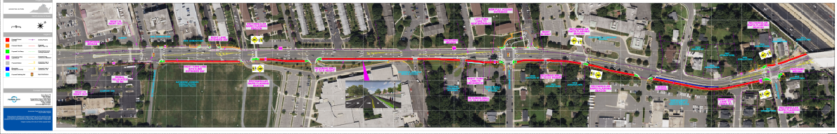
Dec. 11, 2025: UPDATE: View the 60% design and submit comments below. Comments will be accepted through Dec. 19. (Tap the image to view the full-size roll plot exhibited at the Dec. 9 open house.)
###
This west side of Fairfax City is growing and changing. Homes, schools, offices, stores, and bus stops are located along Jermantown Road between Route 50 and I-66. The road provides an important connection to Fairfax County, and improvements in the corridor are needed.
Fairfax City began planning for this project in 2018. The city received $21M from the Northern Virginia Transportation Authority for this project in 2019. The project team studied the Jermantown Road corridor, and a concept plan was created to improve it. General project goals include:
- Make the road wider in some areas
- Make the road safer for walking and biking
- Make it easier to access bus stops
- Reduce the number of driveways
An update on the project was presented to the city council during a work session on Oct. 7, 2025. Watch the discussion.
Planned Improvements
- Replace the two-way left turn lane with median and individual left turn lanes where possible
- Optimize signal timing along the corridor
- Convert full access driveways to right-in/right-out configuration at Comfort Inn entrance, H-Mart north entrance, and the Gainsborough Court south entrance
- Shift the Gainsborough Court north entrance to align with Orchard Street to create a 4-leg signalized intersection
- Shift the traffic signal at the H-Mart north entrance north to align with Kutner Park and 3900 Jermantown
- Construct a continuous 10-foot shared use path along the east side of Jermantown Road
- Add Rapid Flashing Beacons at the pedestrian crossings at Katherine Johnson Middle School, Providence Elementary School and at Carol Street
- Construct a mid-crossing pedestrian island at Carol Street
- Add pedestrian-scale lighting throughout the corridor
- Upgrade CUE and Metro bus stops with benches, bus shelters, bike racks and trash receptables
- Plant 100+ new trees and shrubs throughout the corridor
The need for this project was identified in the comprehensive plan, the multimodal transportation plan, and the Kamp Washington Small Area Plan.
Questions for the project team may be asked below.
Consultation has concluded. Project information is available on the city website.
The project team will answer questions within 2-3 days.
-
Share Thank you for all the great ideas. In the improvements list there was an upgrade of bus stops mentioned, but no note about increasing the frequency of buses. This would aid in efforts to improve public transportation use. Will this be considered? Also, on the list, mention of "new trees" planted raises fears of old trees cut down! Saving old trees should always be a priority because new trees just cannot replace older trees. Maybe that 10' shared use path doesn't have to be so wide. From my experience walking around the city, I never have any trouble on standard-width sidewalks. We don't need unnecessary pavement and especially at the expense of trees, do we? on Facebook Share Thank you for all the great ideas. In the improvements list there was an upgrade of bus stops mentioned, but no note about increasing the frequency of buses. This would aid in efforts to improve public transportation use. Will this be considered? Also, on the list, mention of "new trees" planted raises fears of old trees cut down! Saving old trees should always be a priority because new trees just cannot replace older trees. Maybe that 10' shared use path doesn't have to be so wide. From my experience walking around the city, I never have any trouble on standard-width sidewalks. We don't need unnecessary pavement and especially at the expense of trees, do we? on X (formerly Twitter) Share Thank you for all the great ideas. In the improvements list there was an upgrade of bus stops mentioned, but no note about increasing the frequency of buses. This would aid in efforts to improve public transportation use. Will this be considered? Also, on the list, mention of "new trees" planted raises fears of old trees cut down! Saving old trees should always be a priority because new trees just cannot replace older trees. Maybe that 10' shared use path doesn't have to be so wide. From my experience walking around the city, I never have any trouble on standard-width sidewalks. We don't need unnecessary pavement and especially at the expense of trees, do we? on Linkedin Email Thank you for all the great ideas. In the improvements list there was an upgrade of bus stops mentioned, but no note about increasing the frequency of buses. This would aid in efforts to improve public transportation use. Will this be considered? Also, on the list, mention of "new trees" planted raises fears of old trees cut down! Saving old trees should always be a priority because new trees just cannot replace older trees. Maybe that 10' shared use path doesn't have to be so wide. From my experience walking around the city, I never have any trouble on standard-width sidewalks. We don't need unnecessary pavement and especially at the expense of trees, do we? link
Thank you for all the great ideas. In the improvements list there was an upgrade of bus stops mentioned, but no note about increasing the frequency of buses. This would aid in efforts to improve public transportation use. Will this be considered? Also, on the list, mention of "new trees" planted raises fears of old trees cut down! Saving old trees should always be a priority because new trees just cannot replace older trees. Maybe that 10' shared use path doesn't have to be so wide. From my experience walking around the city, I never have any trouble on standard-width sidewalks. We don't need unnecessary pavement and especially at the expense of trees, do we?
alice asked 8 months agoThank you for your comments. Improving CUE bus service is being discussed separately.
-
Share My Comments: Thank you; I didn't get your replies, but this is better. Posting your answers here lets the entire community see that the site is active. It might also generate more discussion on the site. I attended the open house 12/9, reviewed the proposal, and listened to the project team, the public, and some council members discussing the changes. I watched the public hearing on live stream from home. At the open house I told Wendy I liked the proposal, but I've rethought some of the points after hearing some opposition comments. 1) The artist's sketch of the project that appears on the website contradicts the actual plan shown on the aerial photo mark ups. The sketch shows the road in front of Oxford Row/school as 2 southbound lanes on Jermantown. That’s incorrect. There’s only one. The middle lane markings should show that it's a double turn lane with arrows pointing both left and right, not just one. You should replace this sketch; it’s misleading. 2) I support the flashing signs at crosswalks. YES! A member of our HOA board was hit by a truck walking her dog IN the crosswalk in full daylight. 3) I don't see how moving the signal at H Mart will help. It looks like the plan is to have the new median block the exit to left turns so that the driveway will be a right turn only, both in and out? Right now, the signal is the only safe way for shoppers to exit left onto Jermantown northbound. Does this change force all left turn traffic out of H Mart to go through that single, un-signaled driveway across from 7-11? Yikes! It's no good to say that driveway is outside the scope of the project! There is much more traffic out of H Mart than out of 3900. I don’t understand the reasoning. All the expense to what end? Are you assuming moving the signal to the 3900 driveway would allow H Mart drivers to exit left as well? That can't be--they'd run straight into drivers exiting on the light from 3900 and the park. This could be a nightmare, depending on how cars are meant to exit H Mart. The H Mart owner said you first wanted to route traffic from 3900 onto their property to the light and she was opposed to that. Is it possible to remove the divider between the two properties and make one long open driveway for both? Make it one large open intersection with multiple signals? You need to look at a holistic solution. Dividing things up more won't do it. Or, leave this spot alone unless you can work with whoever controls the 2nd H Mart driveway on Jermantown. It's a 20-year plan. We already know that turning the Fair Oaks Business Park development and the recently sold retail property with Buffalo Wings, Burlington, etc will generate much more traffic as high density residential property. How many more cars can you funnel into that intersection (Jermantown/Fairfax Blvd) without a comprehensive solution? 4) Which brings us to the real issue here: Fairfax City v Fairfax County population growth. The question is whether the City is going to follow the County's lead and rezone every last square foot of low density acreage to allow high density residential development. It's a defining moment for the City. Will it morph from suburban to high density urban a la Mosaic? Turn it into rows of non-descript human warehouses to profit the real estate developers? (H Mart’s owner says she is fending off developers constantly. She's lived in Fairfax City her whole life and she does not want to sell it to them. I also heard that the Comfort Inn has been sold? I feel like we’re facing a tsunami, a massive land grab that’s overwhelming our little homes and city. I wonder if city planners and council members even care what happens to us long time residents.) This stretch of road up to 3900 is suburban residential and schools. Does the 20 year plan envision that remaining or disappearing? 5)Back to the immediate plan. There are two perspectives-- that of the people who live on Jermantown Road and the hundreds/thousands of school children who spend their days here, and that of the people who only drive on Jermantown Road. As someone who’s lived at Oxford Row for 23 years, it's not like I'm not subject to the frustrations of driving on Jermantown. I'm MORE subject to them, because I live here and can’t get into my house any other way. I think city residents (who vote for council members who vote on zoning and projects like these) deserve preference. I prefer the proposed 10 foot pedestrian/bicycle path to widening the road. We residents all along Jermantown like to take our morning strolls, walk our dogs, take our kids to school, exit from our driveway in the morning, without taking our life into our hands to do so. The pedestrian/bike path turns this road into something more than a funnel for cars. I heard one opponent saying she "paid her taxes and she wants ROADS." Wider roads for more cars. I don't agree. Not here. At the end of the day, Fairfax City is where I live. My car is simply a means to that end. If I have to sit in it a while longer than I'd like, so be it. 6) I can see the pro and con of the concrete medians. I agree with the planners that they will better shepherd drivers into the various driveways along the route. But I can also see them causing frustration to drivers who like to be able to pass stopped buses/cars by using the middle lane. They could even cause road rage, impatient drivers speeding up and recklessly passing cars BEFORE they get to the median to leapfrog a few places. I don't know if you should factor these drivers into your design, but anything that makes the road less safe is something to consider. 7) I heard people complaining about bus drivers who swing out into traffic, cutting drivers off, and other examples of breaking rules that the planners said were “enforcement” issues. That's true, but that entire stretch begs for better enforcement. No point making rules if no one ever enforces them. Maybe that’s the City Council’s job, but someone needs to put it on the to-do list. But here’s another thought: Are there ways to facilitate traffic flow that are so intuitive they cut down on infractions? I’m thinking of the markings they designed for turning onto the northbound lanes of Jermantown from the left turn signal on Fairfax Blvd. This was done years ago, but I remember how those lanes were beforehand, and this is a dream compared to the old markings. I wonder if AI could look at the situation and compare similar roadways across the country for other options? on Facebook Share My Comments: Thank you; I didn't get your replies, but this is better. Posting your answers here lets the entire community see that the site is active. It might also generate more discussion on the site. I attended the open house 12/9, reviewed the proposal, and listened to the project team, the public, and some council members discussing the changes. I watched the public hearing on live stream from home. At the open house I told Wendy I liked the proposal, but I've rethought some of the points after hearing some opposition comments. 1) The artist's sketch of the project that appears on the website contradicts the actual plan shown on the aerial photo mark ups. The sketch shows the road in front of Oxford Row/school as 2 southbound lanes on Jermantown. That’s incorrect. There’s only one. The middle lane markings should show that it's a double turn lane with arrows pointing both left and right, not just one. You should replace this sketch; it’s misleading. 2) I support the flashing signs at crosswalks. YES! A member of our HOA board was hit by a truck walking her dog IN the crosswalk in full daylight. 3) I don't see how moving the signal at H Mart will help. It looks like the plan is to have the new median block the exit to left turns so that the driveway will be a right turn only, both in and out? Right now, the signal is the only safe way for shoppers to exit left onto Jermantown northbound. Does this change force all left turn traffic out of H Mart to go through that single, un-signaled driveway across from 7-11? Yikes! It's no good to say that driveway is outside the scope of the project! There is much more traffic out of H Mart than out of 3900. I don’t understand the reasoning. All the expense to what end? Are you assuming moving the signal to the 3900 driveway would allow H Mart drivers to exit left as well? That can't be--they'd run straight into drivers exiting on the light from 3900 and the park. This could be a nightmare, depending on how cars are meant to exit H Mart. The H Mart owner said you first wanted to route traffic from 3900 onto their property to the light and she was opposed to that. Is it possible to remove the divider between the two properties and make one long open driveway for both? Make it one large open intersection with multiple signals? You need to look at a holistic solution. Dividing things up more won't do it. Or, leave this spot alone unless you can work with whoever controls the 2nd H Mart driveway on Jermantown. It's a 20-year plan. We already know that turning the Fair Oaks Business Park development and the recently sold retail property with Buffalo Wings, Burlington, etc will generate much more traffic as high density residential property. How many more cars can you funnel into that intersection (Jermantown/Fairfax Blvd) without a comprehensive solution? 4) Which brings us to the real issue here: Fairfax City v Fairfax County population growth. The question is whether the City is going to follow the County's lead and rezone every last square foot of low density acreage to allow high density residential development. It's a defining moment for the City. Will it morph from suburban to high density urban a la Mosaic? Turn it into rows of non-descript human warehouses to profit the real estate developers? (H Mart’s owner says she is fending off developers constantly. She's lived in Fairfax City her whole life and she does not want to sell it to them. I also heard that the Comfort Inn has been sold? I feel like we’re facing a tsunami, a massive land grab that’s overwhelming our little homes and city. I wonder if city planners and council members even care what happens to us long time residents.) This stretch of road up to 3900 is suburban residential and schools. Does the 20 year plan envision that remaining or disappearing? 5)Back to the immediate plan. There are two perspectives-- that of the people who live on Jermantown Road and the hundreds/thousands of school children who spend their days here, and that of the people who only drive on Jermantown Road. As someone who’s lived at Oxford Row for 23 years, it's not like I'm not subject to the frustrations of driving on Jermantown. I'm MORE subject to them, because I live here and can’t get into my house any other way. I think city residents (who vote for council members who vote on zoning and projects like these) deserve preference. I prefer the proposed 10 foot pedestrian/bicycle path to widening the road. We residents all along Jermantown like to take our morning strolls, walk our dogs, take our kids to school, exit from our driveway in the morning, without taking our life into our hands to do so. The pedestrian/bike path turns this road into something more than a funnel for cars. I heard one opponent saying she "paid her taxes and she wants ROADS." Wider roads for more cars. I don't agree. Not here. At the end of the day, Fairfax City is where I live. My car is simply a means to that end. If I have to sit in it a while longer than I'd like, so be it. 6) I can see the pro and con of the concrete medians. I agree with the planners that they will better shepherd drivers into the various driveways along the route. But I can also see them causing frustration to drivers who like to be able to pass stopped buses/cars by using the middle lane. They could even cause road rage, impatient drivers speeding up and recklessly passing cars BEFORE they get to the median to leapfrog a few places. I don't know if you should factor these drivers into your design, but anything that makes the road less safe is something to consider. 7) I heard people complaining about bus drivers who swing out into traffic, cutting drivers off, and other examples of breaking rules that the planners said were “enforcement” issues. That's true, but that entire stretch begs for better enforcement. No point making rules if no one ever enforces them. Maybe that’s the City Council’s job, but someone needs to put it on the to-do list. But here’s another thought: Are there ways to facilitate traffic flow that are so intuitive they cut down on infractions? I’m thinking of the markings they designed for turning onto the northbound lanes of Jermantown from the left turn signal on Fairfax Blvd. This was done years ago, but I remember how those lanes were beforehand, and this is a dream compared to the old markings. I wonder if AI could look at the situation and compare similar roadways across the country for other options? on X (formerly Twitter) Share My Comments: Thank you; I didn't get your replies, but this is better. Posting your answers here lets the entire community see that the site is active. It might also generate more discussion on the site. I attended the open house 12/9, reviewed the proposal, and listened to the project team, the public, and some council members discussing the changes. I watched the public hearing on live stream from home. At the open house I told Wendy I liked the proposal, but I've rethought some of the points after hearing some opposition comments. 1) The artist's sketch of the project that appears on the website contradicts the actual plan shown on the aerial photo mark ups. The sketch shows the road in front of Oxford Row/school as 2 southbound lanes on Jermantown. That’s incorrect. There’s only one. The middle lane markings should show that it's a double turn lane with arrows pointing both left and right, not just one. You should replace this sketch; it’s misleading. 2) I support the flashing signs at crosswalks. YES! A member of our HOA board was hit by a truck walking her dog IN the crosswalk in full daylight. 3) I don't see how moving the signal at H Mart will help. It looks like the plan is to have the new median block the exit to left turns so that the driveway will be a right turn only, both in and out? Right now, the signal is the only safe way for shoppers to exit left onto Jermantown northbound. Does this change force all left turn traffic out of H Mart to go through that single, un-signaled driveway across from 7-11? Yikes! It's no good to say that driveway is outside the scope of the project! There is much more traffic out of H Mart than out of 3900. I don’t understand the reasoning. All the expense to what end? Are you assuming moving the signal to the 3900 driveway would allow H Mart drivers to exit left as well? That can't be--they'd run straight into drivers exiting on the light from 3900 and the park. This could be a nightmare, depending on how cars are meant to exit H Mart. The H Mart owner said you first wanted to route traffic from 3900 onto their property to the light and she was opposed to that. Is it possible to remove the divider between the two properties and make one long open driveway for both? Make it one large open intersection with multiple signals? You need to look at a holistic solution. Dividing things up more won't do it. Or, leave this spot alone unless you can work with whoever controls the 2nd H Mart driveway on Jermantown. It's a 20-year plan. We already know that turning the Fair Oaks Business Park development and the recently sold retail property with Buffalo Wings, Burlington, etc will generate much more traffic as high density residential property. How many more cars can you funnel into that intersection (Jermantown/Fairfax Blvd) without a comprehensive solution? 4) Which brings us to the real issue here: Fairfax City v Fairfax County population growth. The question is whether the City is going to follow the County's lead and rezone every last square foot of low density acreage to allow high density residential development. It's a defining moment for the City. Will it morph from suburban to high density urban a la Mosaic? Turn it into rows of non-descript human warehouses to profit the real estate developers? (H Mart’s owner says she is fending off developers constantly. She's lived in Fairfax City her whole life and she does not want to sell it to them. I also heard that the Comfort Inn has been sold? I feel like we’re facing a tsunami, a massive land grab that’s overwhelming our little homes and city. I wonder if city planners and council members even care what happens to us long time residents.) This stretch of road up to 3900 is suburban residential and schools. Does the 20 year plan envision that remaining or disappearing? 5)Back to the immediate plan. There are two perspectives-- that of the people who live on Jermantown Road and the hundreds/thousands of school children who spend their days here, and that of the people who only drive on Jermantown Road. As someone who’s lived at Oxford Row for 23 years, it's not like I'm not subject to the frustrations of driving on Jermantown. I'm MORE subject to them, because I live here and can’t get into my house any other way. I think city residents (who vote for council members who vote on zoning and projects like these) deserve preference. I prefer the proposed 10 foot pedestrian/bicycle path to widening the road. We residents all along Jermantown like to take our morning strolls, walk our dogs, take our kids to school, exit from our driveway in the morning, without taking our life into our hands to do so. The pedestrian/bike path turns this road into something more than a funnel for cars. I heard one opponent saying she "paid her taxes and she wants ROADS." Wider roads for more cars. I don't agree. Not here. At the end of the day, Fairfax City is where I live. My car is simply a means to that end. If I have to sit in it a while longer than I'd like, so be it. 6) I can see the pro and con of the concrete medians. I agree with the planners that they will better shepherd drivers into the various driveways along the route. But I can also see them causing frustration to drivers who like to be able to pass stopped buses/cars by using the middle lane. They could even cause road rage, impatient drivers speeding up and recklessly passing cars BEFORE they get to the median to leapfrog a few places. I don't know if you should factor these drivers into your design, but anything that makes the road less safe is something to consider. 7) I heard people complaining about bus drivers who swing out into traffic, cutting drivers off, and other examples of breaking rules that the planners said were “enforcement” issues. That's true, but that entire stretch begs for better enforcement. No point making rules if no one ever enforces them. Maybe that’s the City Council’s job, but someone needs to put it on the to-do list. But here’s another thought: Are there ways to facilitate traffic flow that are so intuitive they cut down on infractions? I’m thinking of the markings they designed for turning onto the northbound lanes of Jermantown from the left turn signal on Fairfax Blvd. This was done years ago, but I remember how those lanes were beforehand, and this is a dream compared to the old markings. I wonder if AI could look at the situation and compare similar roadways across the country for other options? on Linkedin Email My Comments: Thank you; I didn't get your replies, but this is better. Posting your answers here lets the entire community see that the site is active. It might also generate more discussion on the site. I attended the open house 12/9, reviewed the proposal, and listened to the project team, the public, and some council members discussing the changes. I watched the public hearing on live stream from home. At the open house I told Wendy I liked the proposal, but I've rethought some of the points after hearing some opposition comments. 1) The artist's sketch of the project that appears on the website contradicts the actual plan shown on the aerial photo mark ups. The sketch shows the road in front of Oxford Row/school as 2 southbound lanes on Jermantown. That’s incorrect. There’s only one. The middle lane markings should show that it's a double turn lane with arrows pointing both left and right, not just one. You should replace this sketch; it’s misleading. 2) I support the flashing signs at crosswalks. YES! A member of our HOA board was hit by a truck walking her dog IN the crosswalk in full daylight. 3) I don't see how moving the signal at H Mart will help. It looks like the plan is to have the new median block the exit to left turns so that the driveway will be a right turn only, both in and out? Right now, the signal is the only safe way for shoppers to exit left onto Jermantown northbound. Does this change force all left turn traffic out of H Mart to go through that single, un-signaled driveway across from 7-11? Yikes! It's no good to say that driveway is outside the scope of the project! There is much more traffic out of H Mart than out of 3900. I don’t understand the reasoning. All the expense to what end? Are you assuming moving the signal to the 3900 driveway would allow H Mart drivers to exit left as well? That can't be--they'd run straight into drivers exiting on the light from 3900 and the park. This could be a nightmare, depending on how cars are meant to exit H Mart. The H Mart owner said you first wanted to route traffic from 3900 onto their property to the light and she was opposed to that. Is it possible to remove the divider between the two properties and make one long open driveway for both? Make it one large open intersection with multiple signals? You need to look at a holistic solution. Dividing things up more won't do it. Or, leave this spot alone unless you can work with whoever controls the 2nd H Mart driveway on Jermantown. It's a 20-year plan. We already know that turning the Fair Oaks Business Park development and the recently sold retail property with Buffalo Wings, Burlington, etc will generate much more traffic as high density residential property. How many more cars can you funnel into that intersection (Jermantown/Fairfax Blvd) without a comprehensive solution? 4) Which brings us to the real issue here: Fairfax City v Fairfax County population growth. The question is whether the City is going to follow the County's lead and rezone every last square foot of low density acreage to allow high density residential development. It's a defining moment for the City. Will it morph from suburban to high density urban a la Mosaic? Turn it into rows of non-descript human warehouses to profit the real estate developers? (H Mart’s owner says she is fending off developers constantly. She's lived in Fairfax City her whole life and she does not want to sell it to them. I also heard that the Comfort Inn has been sold? I feel like we’re facing a tsunami, a massive land grab that’s overwhelming our little homes and city. I wonder if city planners and council members even care what happens to us long time residents.) This stretch of road up to 3900 is suburban residential and schools. Does the 20 year plan envision that remaining or disappearing? 5)Back to the immediate plan. There are two perspectives-- that of the people who live on Jermantown Road and the hundreds/thousands of school children who spend their days here, and that of the people who only drive on Jermantown Road. As someone who’s lived at Oxford Row for 23 years, it's not like I'm not subject to the frustrations of driving on Jermantown. I'm MORE subject to them, because I live here and can’t get into my house any other way. I think city residents (who vote for council members who vote on zoning and projects like these) deserve preference. I prefer the proposed 10 foot pedestrian/bicycle path to widening the road. We residents all along Jermantown like to take our morning strolls, walk our dogs, take our kids to school, exit from our driveway in the morning, without taking our life into our hands to do so. The pedestrian/bike path turns this road into something more than a funnel for cars. I heard one opponent saying she "paid her taxes and she wants ROADS." Wider roads for more cars. I don't agree. Not here. At the end of the day, Fairfax City is where I live. My car is simply a means to that end. If I have to sit in it a while longer than I'd like, so be it. 6) I can see the pro and con of the concrete medians. I agree with the planners that they will better shepherd drivers into the various driveways along the route. But I can also see them causing frustration to drivers who like to be able to pass stopped buses/cars by using the middle lane. They could even cause road rage, impatient drivers speeding up and recklessly passing cars BEFORE they get to the median to leapfrog a few places. I don't know if you should factor these drivers into your design, but anything that makes the road less safe is something to consider. 7) I heard people complaining about bus drivers who swing out into traffic, cutting drivers off, and other examples of breaking rules that the planners said were “enforcement” issues. That's true, but that entire stretch begs for better enforcement. No point making rules if no one ever enforces them. Maybe that’s the City Council’s job, but someone needs to put it on the to-do list. But here’s another thought: Are there ways to facilitate traffic flow that are so intuitive they cut down on infractions? I’m thinking of the markings they designed for turning onto the northbound lanes of Jermantown from the left turn signal on Fairfax Blvd. This was done years ago, but I remember how those lanes were beforehand, and this is a dream compared to the old markings. I wonder if AI could look at the situation and compare similar roadways across the country for other options? link
My Comments: Thank you; I didn't get your replies, but this is better. Posting your answers here lets the entire community see that the site is active. It might also generate more discussion on the site. I attended the open house 12/9, reviewed the proposal, and listened to the project team, the public, and some council members discussing the changes. I watched the public hearing on live stream from home. At the open house I told Wendy I liked the proposal, but I've rethought some of the points after hearing some opposition comments. 1) The artist's sketch of the project that appears on the website contradicts the actual plan shown on the aerial photo mark ups. The sketch shows the road in front of Oxford Row/school as 2 southbound lanes on Jermantown. That’s incorrect. There’s only one. The middle lane markings should show that it's a double turn lane with arrows pointing both left and right, not just one. You should replace this sketch; it’s misleading. 2) I support the flashing signs at crosswalks. YES! A member of our HOA board was hit by a truck walking her dog IN the crosswalk in full daylight. 3) I don't see how moving the signal at H Mart will help. It looks like the plan is to have the new median block the exit to left turns so that the driveway will be a right turn only, both in and out? Right now, the signal is the only safe way for shoppers to exit left onto Jermantown northbound. Does this change force all left turn traffic out of H Mart to go through that single, un-signaled driveway across from 7-11? Yikes! It's no good to say that driveway is outside the scope of the project! There is much more traffic out of H Mart than out of 3900. I don’t understand the reasoning. All the expense to what end? Are you assuming moving the signal to the 3900 driveway would allow H Mart drivers to exit left as well? That can't be--they'd run straight into drivers exiting on the light from 3900 and the park. This could be a nightmare, depending on how cars are meant to exit H Mart. The H Mart owner said you first wanted to route traffic from 3900 onto their property to the light and she was opposed to that. Is it possible to remove the divider between the two properties and make one long open driveway for both? Make it one large open intersection with multiple signals? You need to look at a holistic solution. Dividing things up more won't do it. Or, leave this spot alone unless you can work with whoever controls the 2nd H Mart driveway on Jermantown. It's a 20-year plan. We already know that turning the Fair Oaks Business Park development and the recently sold retail property with Buffalo Wings, Burlington, etc will generate much more traffic as high density residential property. How many more cars can you funnel into that intersection (Jermantown/Fairfax Blvd) without a comprehensive solution? 4) Which brings us to the real issue here: Fairfax City v Fairfax County population growth. The question is whether the City is going to follow the County's lead and rezone every last square foot of low density acreage to allow high density residential development. It's a defining moment for the City. Will it morph from suburban to high density urban a la Mosaic? Turn it into rows of non-descript human warehouses to profit the real estate developers? (H Mart’s owner says she is fending off developers constantly. She's lived in Fairfax City her whole life and she does not want to sell it to them. I also heard that the Comfort Inn has been sold? I feel like we’re facing a tsunami, a massive land grab that’s overwhelming our little homes and city. I wonder if city planners and council members even care what happens to us long time residents.) This stretch of road up to 3900 is suburban residential and schools. Does the 20 year plan envision that remaining or disappearing? 5)Back to the immediate plan. There are two perspectives-- that of the people who live on Jermantown Road and the hundreds/thousands of school children who spend their days here, and that of the people who only drive on Jermantown Road. As someone who’s lived at Oxford Row for 23 years, it's not like I'm not subject to the frustrations of driving on Jermantown. I'm MORE subject to them, because I live here and can’t get into my house any other way. I think city residents (who vote for council members who vote on zoning and projects like these) deserve preference. I prefer the proposed 10 foot pedestrian/bicycle path to widening the road. We residents all along Jermantown like to take our morning strolls, walk our dogs, take our kids to school, exit from our driveway in the morning, without taking our life into our hands to do so. The pedestrian/bike path turns this road into something more than a funnel for cars. I heard one opponent saying she "paid her taxes and she wants ROADS." Wider roads for more cars. I don't agree. Not here. At the end of the day, Fairfax City is where I live. My car is simply a means to that end. If I have to sit in it a while longer than I'd like, so be it. 6) I can see the pro and con of the concrete medians. I agree with the planners that they will better shepherd drivers into the various driveways along the route. But I can also see them causing frustration to drivers who like to be able to pass stopped buses/cars by using the middle lane. They could even cause road rage, impatient drivers speeding up and recklessly passing cars BEFORE they get to the median to leapfrog a few places. I don't know if you should factor these drivers into your design, but anything that makes the road less safe is something to consider. 7) I heard people complaining about bus drivers who swing out into traffic, cutting drivers off, and other examples of breaking rules that the planners said were “enforcement” issues. That's true, but that entire stretch begs for better enforcement. No point making rules if no one ever enforces them. Maybe that’s the City Council’s job, but someone needs to put it on the to-do list. But here’s another thought: Are there ways to facilitate traffic flow that are so intuitive they cut down on infractions? I’m thinking of the markings they designed for turning onto the northbound lanes of Jermantown from the left turn signal on Fairfax Blvd. This was done years ago, but I remember how those lanes were beforehand, and this is a dream compared to the old markings. I wonder if AI could look at the situation and compare similar roadways across the country for other options?
Jermantown Road Resident asked 7 months agoThank you for your comments and suggestions.
-
Share I have not received an answer to my questions in a week. Is anybody monitoring this site? Do you want comments here in this question box? Why doesn't it say COMMENTS anywhere? There are are two days left for public comment. Please advise! on Facebook Share I have not received an answer to my questions in a week. Is anybody monitoring this site? Do you want comments here in this question box? Why doesn't it say COMMENTS anywhere? There are are two days left for public comment. Please advise! on X (formerly Twitter) Share I have not received an answer to my questions in a week. Is anybody monitoring this site? Do you want comments here in this question box? Why doesn't it say COMMENTS anywhere? There are are two days left for public comment. Please advise! on Linkedin Email I have not received an answer to my questions in a week. Is anybody monitoring this site? Do you want comments here in this question box? Why doesn't it say COMMENTS anywhere? There are are two days left for public comment. Please advise! link
I have not received an answer to my questions in a week. Is anybody monitoring this site? Do you want comments here in this question box? Why doesn't it say COMMENTS anywhere? There are are two days left for public comment. Please advise!
Jermantown Road Resident asked 7 months agoYes, please leave your comments here. Two replies were sent to you. Perhaps they were flagged as junk mail. Our apologies. Thank you for your persistence.
-
Share 1- Please make it so no pedestrian ever has to cross more than two traffic lanes by making use of island/shelters. If done right they can also be an opportunity for additional vegetation 2- I lived last year in a city where the speed limit was 20mph. No one would exceed that speed because of effective traffic calming devices (none of which were speed bumps nor flashing lights). When the speed is 20mph, cars yield to pedestrians without effort. We have an opportunity to make this stroad into a street respectful of non-vehicular users. on Facebook Share 1- Please make it so no pedestrian ever has to cross more than two traffic lanes by making use of island/shelters. If done right they can also be an opportunity for additional vegetation 2- I lived last year in a city where the speed limit was 20mph. No one would exceed that speed because of effective traffic calming devices (none of which were speed bumps nor flashing lights). When the speed is 20mph, cars yield to pedestrians without effort. We have an opportunity to make this stroad into a street respectful of non-vehicular users. on X (formerly Twitter) Share 1- Please make it so no pedestrian ever has to cross more than two traffic lanes by making use of island/shelters. If done right they can also be an opportunity for additional vegetation 2- I lived last year in a city where the speed limit was 20mph. No one would exceed that speed because of effective traffic calming devices (none of which were speed bumps nor flashing lights). When the speed is 20mph, cars yield to pedestrians without effort. We have an opportunity to make this stroad into a street respectful of non-vehicular users. on Linkedin Email 1- Please make it so no pedestrian ever has to cross more than two traffic lanes by making use of island/shelters. If done right they can also be an opportunity for additional vegetation 2- I lived last year in a city where the speed limit was 20mph. No one would exceed that speed because of effective traffic calming devices (none of which were speed bumps nor flashing lights). When the speed is 20mph, cars yield to pedestrians without effort. We have an opportunity to make this stroad into a street respectful of non-vehicular users. link
1- Please make it so no pedestrian ever has to cross more than two traffic lanes by making use of island/shelters. If done right they can also be an opportunity for additional vegetation 2- I lived last year in a city where the speed limit was 20mph. No one would exceed that speed because of effective traffic calming devices (none of which were speed bumps nor flashing lights). When the speed is 20mph, cars yield to pedestrians without effort. We have an opportunity to make this stroad into a street respectful of non-vehicular users.
patricklf asked about 3 years agoThank you for your feedback. Your comments will be included in the project record for consideration.
Signup Banner
60% Plans
-
 Jermantown Road - PH Aerial Scroll (2).pdf (8.73 MB) (pdf)
-
Jermantown Road - Volume 1 (General Information Existing Conditions).pdf (5.62 MB) (pdf)
-
Jermantown Road - Volume 2 (Drainage Stormwater Management).pdf (2.34 MB) (pdf)
-
Jermantown Road - Volume 3 (Erosion Sediment Control Plans).pdf (6.98 MB) (pdf)
-
Jermantown Road - Volume 4 (Roadway Traffic Control Plans).pdf (24.3 MB) (pdf)
-
Jermantown Road - Volume 5 (Landscaping Tree Protection Plans).pdf (6.43 MB) (pdf)
-
Jermantown Road - Volume 6 (Street Lighting Plans).pdf (7.01 MB) (pdf)
-
Jermantown Road - Volume 8 (Specialty Sheets).pdf (8.35 MB) (pdf)
-
Jermantown Road - Volume 10 (Cross Sections).pdf (2.16 MB) (pdf)

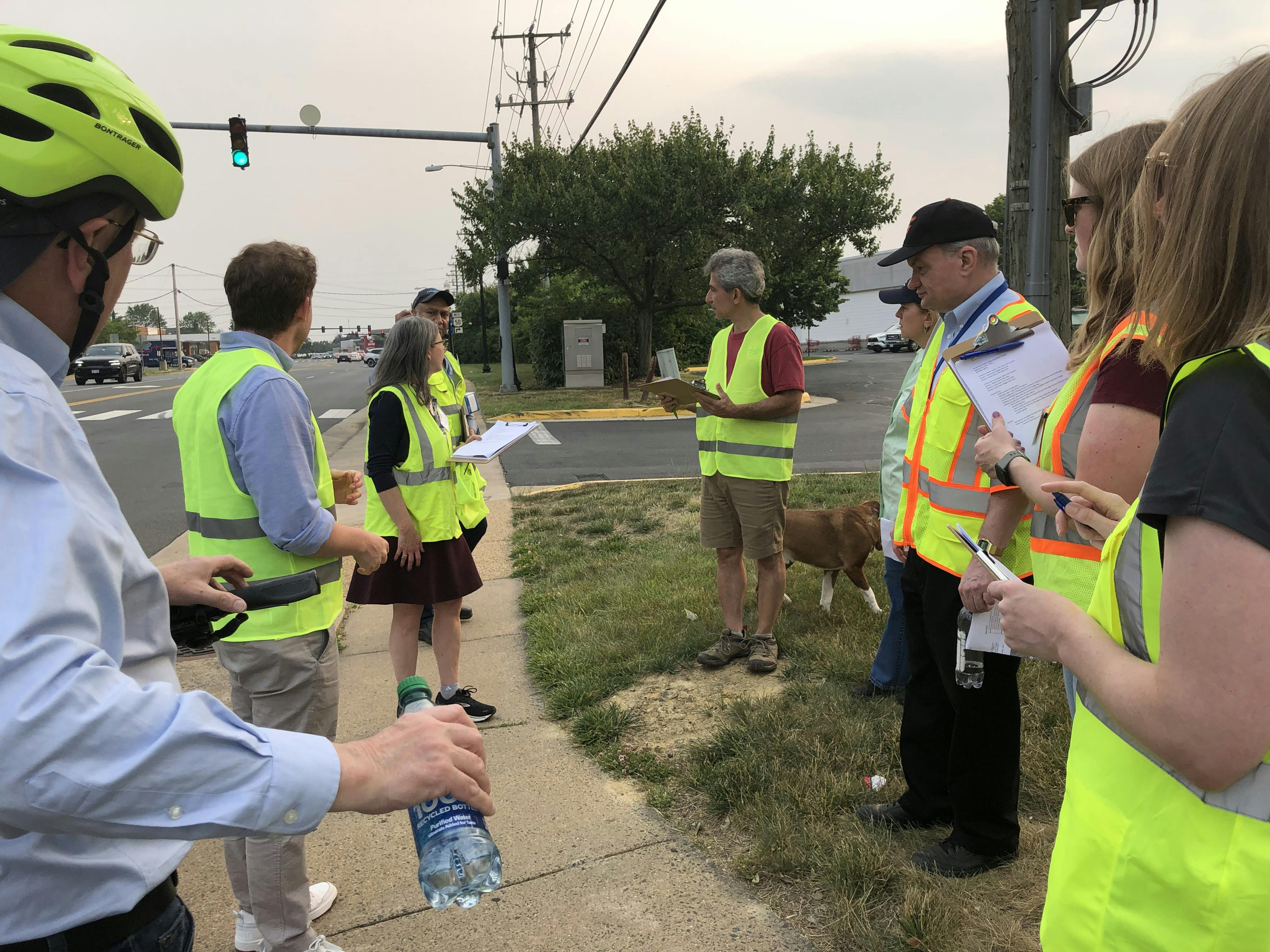
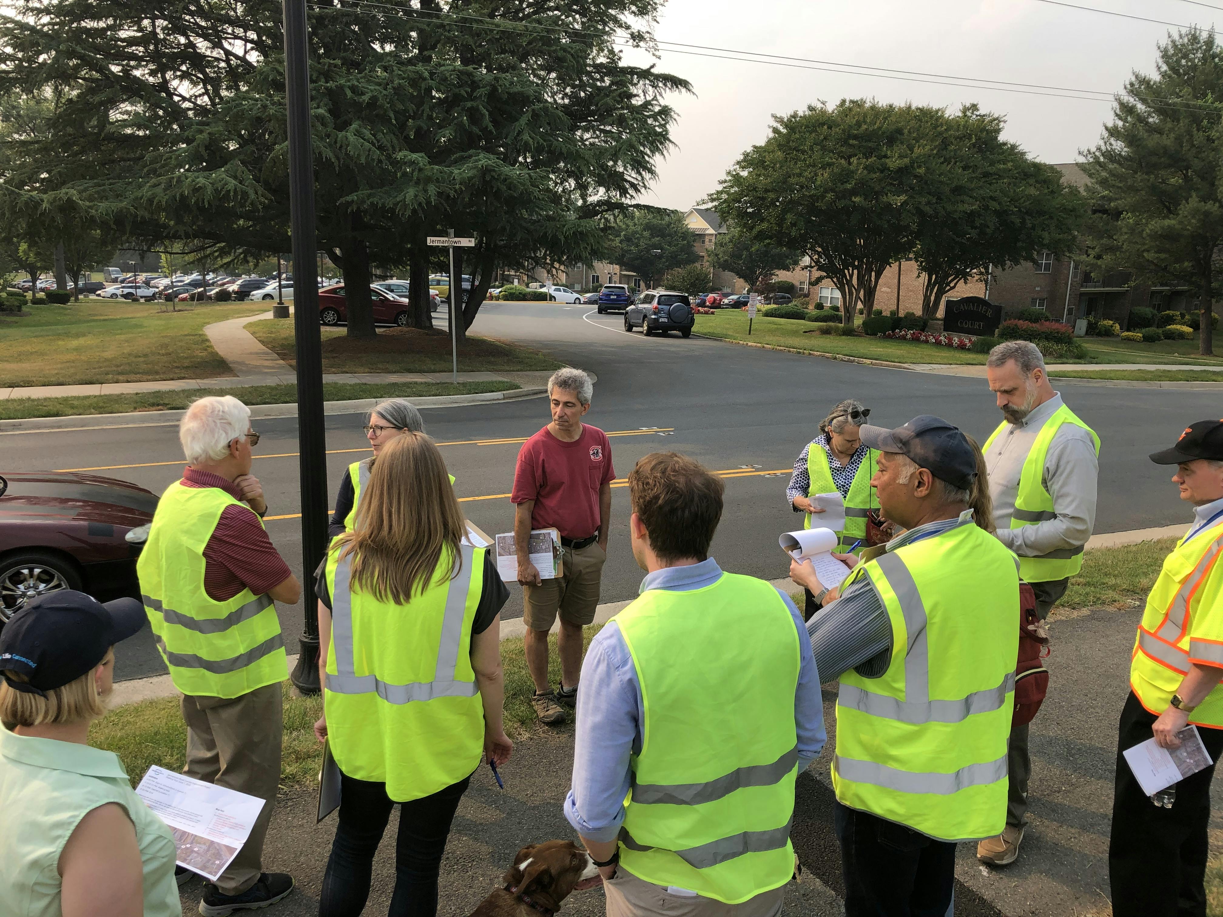
Dec. 9: Public Hearing and Open House
-
December 09 2025
Oct. 7, 2025 Work Session Presentation
Project Timeline
-
Conceptual Planning Study - 2018
Jermantown Road Corridor Improvements has finished this stage -
$21M in funding from NVTA - 2019
Jermantown Road Corridor Improvements has finished this stage -
Concept Development
Jermantown Road Corridor Improvements has finished this stageThe project team is developing a concept for the corridor in coordination with the public and other stakeholders.
-
60% Design Public Hearing - Dec. 9, 2025
Jermantown Road Corridor Improvements has finished this stage60% design will be presented to the city council.
-
Right-of-Way Acquisition and Utilities Relocation - 2026-27
Jermantown Road Corridor Improvements is currently at this stageRight-of-way is required from 18 properties. Impacted utilities include communications, electric, gas, and water.
-
100% Plans Complete - Aug. 2027
this is an upcoming stage for Jermantown Road Corridor Improvements -
Construction Bidding - Dec. 2027
this is an upcoming stage for Jermantown Road Corridor Improvements -
Construction - 2027-29
this is an upcoming stage for Jermantown Road Corridor Improvements